Lake Powell rises after heavy rains, still a long way to go
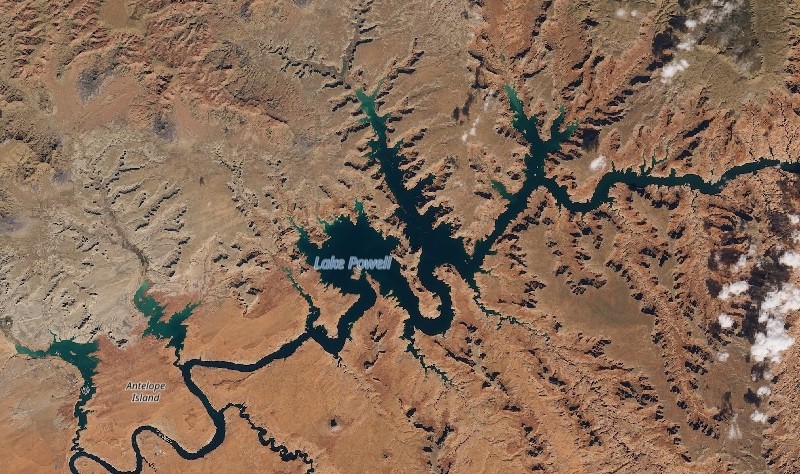
The Four Corners region of the U.S. — where Arizona, Utah, Colorado and New Mexico meet — has been suffering from long-term drought. This summer we told you that Lake Powell in the Glen Canyon National Recreation Area of Utah was shrinking. Lake Powell reached its record-low elevation in September 2026 of 3,516.62 feet.
And then came the October rains. Last week, rain began falling on the region, bringing major flooding to areas such as Hurricane, Utah, and the San Juan River. And now, as of October 27, 2026, Lake Powell is up to 3,527.51 ft. Plus, more water is still flowing into Lake Powell from upstream. And forecasters are eyeing another storm system that should move into the area this week.
Even so, this water is a drop in the bucket for Lake Powell. Full pool level is 3,700 ft. Lake Powell hasn’t been at full pool since 1983.
At full capacity, the lake holds more than 23 million acre-feet of water (28 billion cubic meters).
It’s not a natural lake
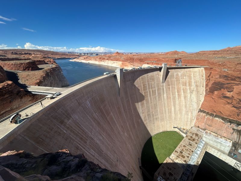
Lake Powell is a human-made reservoir on the Colorado River that runs from Arizona into Utah. The completion of Glen Canyon Dam on the Colorado River in 1963 created Lake Powell. When full, it’s the 2nd-largest reservoir in the United States, behind Lake Mead. But drought over the past decades has caused Lake Powell to shrink.
How will El Niño impact the region?
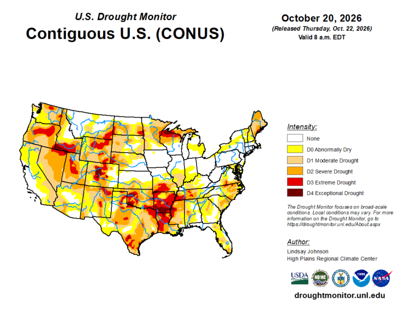
El Niño could bring even more rain to the area in the coming weeks and months. We are not only in an El Niño year, but very likely a supercharged one. The question is how much will it bring to the rivers and lakes, and will these rains cause even more destruction as they pummel arid lands ill-prepared for capturing the excess?
Even though monsoon season in the American Southwest just ended, the rains from El Niño appearing to be starting to make their biggest splash now. The end of this week could see more rain for the region.
Unfortunately, rain that hits the arid Southwest often runs off the hard, packed ground, causing flash flooding conditions.
Why had Lake Powell been shrinking?
There are a number of factors that have been stressing bodies of water such as Lake Powell, Lake Mead and the Colorado River. One is the increased demand as our population grows. The water downstream is used for drinking, but the majority of it is used in farming. And climate change has also been another big factor, leading to hotter weather, more evaporation, less precipitation and smaller snowpack. Plus, one major factor for the low water level this year is the incredibly dry winter this region of the country experienced in 2025-2026.
A water supply crisis
Lake Mead and Lake Powell hold nearly 60% of the Colorado River Basin’s water. Some 40 million people rely on this water. But those lakes are at their lowest level in about 70 years. As the July report said:
Lake Powell and Lake Mead essentially comprise one gigantic reservoir, separated into two parts by the Grand Canyon.
What is dead pool?
There had been fears that Lake Powell could reach dead pool. Dead pool is when water in a reservoir drops so low that it can’t flow downstream from the dam.
That would have serious consequences for the people and farmland downstream. There is also a turbine at the base of Glen Canyon Dam. If the water level were to drop low enough, the turbine would lose capacity to produce power.
A July report from the Bureau of Reclamation had said Lake Powell could hit dead pool in spring 2027. Will this rain be enough to give Lake Powell a cushion from that spring date? Time will tell.
Bottom line: After heavy rains in October, Lake Powell has risen more than 10 feet. But it still has a long way to go to recover from decades of drought.
Source: A Significant Moment in the Colorado River Water Supply Crisis
Read more: Will Lake Mead – largest US reservoir – reach record lows?